UN
308 City Way
£ 275,000
Description
We don't have a Description for this property.
- Bedrooms
- 5
- Bathrooms
- 0
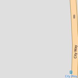


Leaflet © OpenStreetMap contributors
The heatmap indicates the level of crime in the area. The color of the heatmap indicates the crime severity and recency.
Metrics Year-on-Year
- Average area value
- 295,897.00 £Increased by 1.34 %
- Average area rental value
- 1,067.00 £/moDecreased by 10.11 %
- Est rental Yield
- 4.33 %Decreased by 11.27 %
- Crime Rate
- 4.00 %Unchanged by 0.00 %
from 291,993.00 £
from 1,187.00 £/mo
from 4.88 %
from 4.00 %
Nearby Schools
| Name | Type | Ofsted | Distance |
|---|---|---|---|
| Balfour Infant School | Community School | Good | 0.41 KM |
| Crest Infant School | Community School | Good | 0.42 KM |
| Delce Children'S Centre | Children's Centre | 0.48 KM | |
| Delce Academy | Academy Converter | 0.60 KM | |
| Balfour Junior School | Academy Converter | Good | 0.60 KM |
Images
Nearby Streets
| Name | Average Price | Average Sqft | Distance |
|---|---|---|---|
| Anchor Road | £ 365,000 | 0 | 0.00 KM |
| St Alban's Walk | £ 0 | 0 | 0.00 KM |
| The Cut | £ 462,500 | 0 | 0.00 KM |
| Leander Road | £ 0 | 0 | 0.00 KM |
| New Road | £ 190,000 | 0 | 0.00 KM |
Nearby Transport
| Name | NLC | TLC | Distance |
|---|---|---|---|
| Chatham | 5199 | CTM | 1.58 KM |
| Rochester | 5203 | RTR | 1.61 KM |
| Strood (Kent) | 5191 | SOO | 3.05 KM |
| Gillingham (Kent) | 5169 | GLM | 4.70 KM |
| Cuxton | 5201 | CUX | 5.39 KM |
Nearby Listings
| Address | Price | Type | Score | Distance |
|---|---|---|---|---|
| City Way, Rochester | £ 650,000 | BUY | Unknown | 0.02 KM |
| City Way, Rochester, ME1 | £ 500,000 | BUY | 7 / 10 | 0.02 KM |
| City Way, Rochester | £ 420,000 | BUY | 5 / 10 | 0.08 KM |
| City Way, Rochester | £ 500,000 | BUY | Unknown | 0.08 KM |
| City Way, Rochester | £ 570,000 | BUY | 6 / 10 | 0.08 KM |
Nearby Properties
| Address | Price | Distance |
|---|---|---|
| 284 City Way | £ 220,000 | 0.00 KM |
| 304 City Way | £ 290,000 | 0.00 KM |
| 308 City Way | £ 275,000 | 0.00 KM |
| 290 City Way | £ 258,000 | 0.00 KM |
| 286 City Way | £ 216,000 | 0.00 KM |